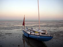
By mid afternoon, we finally cleared the channel and set course to sail down the Everglades Coast. We were able to carry full sail, but the moderate to brisk breeze was nearly dead on the nose. The pounding was back, although not as bad as the previous night, and progress was better as we tacked down the coast. But the problem was I was tired, in fact more tired than I realized. My total real sleep to that point was a couple hours, and since morning I had spent around three hours at the oars rowing in and out of Chokoloskee. Not hard work, but cumulatively a bit of an effort. The ride was rough enough that I knew I would get little sleep below, not to mention having to come on deck on the port tack because of the brisk breeze. After Noel, at the helm, had beat a few miles down the coast, he gently suggested we anchor at the north end of Pavilion Key, protected from the winds and waves. I instantly thought it a brilliant idea. He later told me I was completely unfocused, puttering at small jobs on the boat, but starting one, leaving it half finished to start another, and then leaving that one. Just after 5 p.m., we were anchored in a few inches of water, admiring the wide, unspoiled beach. (We didn't know it at the time, but Greybeard and Ridgerunner elected to pull in at Mormon Key, about a mile or two further south from us, to hopefully wait for a more favorable wind shift.)
 |
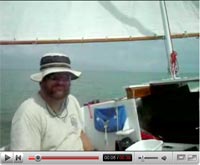
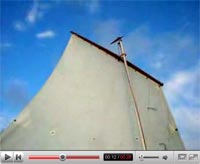
VIDEO CLIP
Late in the afternoon at Pavillion Key
0:38 |
About the only drawback was our cell phones wouldn't reach; we couldn't report our delay to our respective spouses. The weather forecasts spoke of a predicted wind shift the next day to the southwest, which would let us sail down the cost with few, and perhaps no, tacks. The consolation for stopping was a chance to appreciate the beautiful key, with a wide, sandy beach, shells galore, and a wooded crest to the key. Noel used the ebbing afternoon light to do some exploring, but I settled for a short walk, a hot dinner and going to bed not long after admiring the starlight night sky. Noel graciously volunteer to sleep on a cockpit seat (which turned out to be about an inch shorter than he is) so I could have the cabin. He awoke in the middle of the night and heard a sound. He shined a flashlight on the beach and saw five racoons, in what he said was a military formation, eyeing Oaracle apparently expecting it held a trove of delectable goodies. But the critters declined to charge, so the midnight battle of Pavilion Key beach was postponed.
After eight or nine hours of solid sleep I awoke around 7 a.m., to find Oaracle high and dry at low tide. That wasn't an immediate problem as I planned a good breakfast, but the water was more than 100 yards away. Well it at least allowed time for breakfast. Then we found that by climbing to a high point on the beach, we could just make cell phone contact. I told Helen about our stop over (strictly against her orders to keep going and take turns sleeping) and warned with the contrary winds, it could still take two days to reach checkpoint 3 at Flamingo. At 8 a.m., the water still seemed a good ways off, but coming fairly quickly.
 |
A few minutes later, we were afloat. |
Around 8:15, we were afloat and away. Noel steered us away from Pavilion on a moderate breeze while I shot a quick video clip, and then I took the helm. The wind the previous day had been southeast to south-south east. Now it had gone closer to southerly, which mean long and short tacks, with the starboard tack being favored.
I was a bit worried because our beating up to this point had been tiring and slow. But now we seemed to have hit more favorable wave conditions, as we soared over the crests. The GPS track (which reads in MPH, not knots), showed speeds of 4 and 5, and then as the wind built, 5 and 6. At one point, there was a prolonged burst to 7, or about 6 knots, which is exceptional on-the-wind performance for a lightweight, well-loaded 20 foot boat. The compass gave the tacks as around 100 degrees and sometimes less, excellent performance for a balanced lug sail. Alas, after the race the GPS track was not so favorable, indicated that leeway or current was costing us another 10 degrees on each tack, probably not surprising given our light weight and the waves. But the sailing was glorious, with Oaracle swooping over the crests. I seldom have enjoyed a sail more. Shortly afternoon, a fresh gust came along and I had the ease the main for several minutes. A bit later, the wind increased in earnest and I called up Noel, who had been resting below as we were on starboard tack up. He took the helm as, after a slight delay when the main refused to come down (the sheet hadn't been eased sufficiently), the sail was lowered and reefed. Then it was back to the invigorating sailing. now with some whitecaps tumbling off the wave tops.
Oaracle's VMG was 2 knots, maybe a little better, about the best she does hard on the wind. But I also noticed that Noel was increasingly and unusually silent. (In the dictionary next to the word "exuberant" is a picture of Noel.) Now he was quiet and spent most of the time resting below when we were on starboard tack. In the cockpit on the shorter port tacks, he looked grey. And as we approached seven hours of sailing, all hard on the wind, since leaving Pavilion Key, I was in need of a break. I suggested Noel check the chart for a place to stop and he readily agreed. He quickly found the entrance to Lostman's River and guided me there in about 20 minutes. He later confided his virus was definitely worse, and he not only felt fluish but was afraid to eat anything solid lest it not stay down.
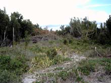
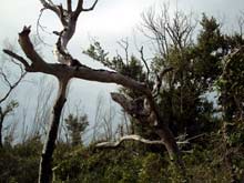
South Lostman's, the island at the entrance of the river, proved a good cure.
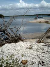 |
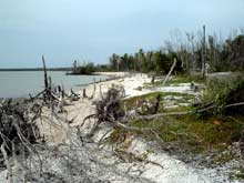
These shots show why we didn’t mind an unscheduled rest stop at the entrance to Lostman’s River.
|
We beached Oaracle on a bar of crushed shells and set out to explore. The island had obviously taken a heavy hit from the hurricanes in 2005. Dead and twisted trees and mangroves littered the breach, and we found a neat, wide swath of trees down in one upland area.
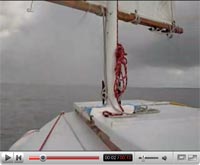
 |
VIDEO CLIP
The entrance of Lostmans River
0:26 |
We figured a twister had touched down in one of the storms. Our plan, after moving Oaracle to a better spot (the shell bar would be under water at high tide), was to relax, eat (well, I would. Noel still didn't trust solid food) and leave perhaps some time before midnight. We silently thanked Helen for having the foresight to add mosquito repellent to Oaracle's supplies, as the critters swarmed out at sunset. But the repellant was only partially effective. It would keep the bugs from landing and biting, but not from nonstop buzzing of any exposed skin. Noel swears one group picked his arm up and flopped it over seeking a better vein. I was wrapped up in my foul weather gear, with hood up and billed cap pulled low over my eyes, leaving about a inch wide slit to breath through, and still they buzzed.
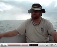
 |
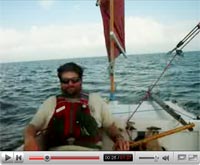
Noel exaggerates the strain of sailing with the author in an Everglades Challenge.
|
About 9 p.m., we decided to leave, as any further real rest seemed academic. The wind seemed light, but as insurance we left the reef in until we were offshore. Even more encouraging, the weather forecast again promised that elusive windshift to the southwest after midnight (oh when would we learn). Guided by the GPS, Noel steered while I rowed against a slight incoming tide. After a bit of a pull at the oars, we soon had the sail up and – confirming the light wind – unreefed. Our speed was at best two knots, and because we had to tack, our VMG toward Cape Sable was seldom more than 1 knot. As the cape, the turning point to get to CP3, was 29 miles away, this did not augur well for an early arrival. But there was nothing to do but settle in and keep sailing, and that we did, taking turns through the night at the helm. The sailing was actually quite pleasant. The seas were calm, the wind steady if light, but what should have been a peaceable amble down the coast was undermined a bit by the notion that this was sort of a race and we weren’t making much progress. The wind did pick up a bit to allow our speed to increase to around 3 knots, but it was still slow going. But bit by bit we edged down the coast. After sunrise, I went below for a doze (no real sleep, but comfortable) and came up to find Noel had worked some more magic. He had finally cleared Northwest Cape at Cape Sable, which allowed a slight easterly change in course, which coincided with a slight westerly shift in the wind.
 |
VIDEO CLIP
The narration is wrong, we were already between Northwest Cape and Middle Cape
1:37 |
Suddenly we were proceeding down the without tacking, although still hard on the wind. The wind also came up a bit and we were doing 4 knots and sometimes a bit more. After an hour, we rounded Middle Cape – without tacking – and the weather gods were even kinder. In addition to a more easterly course, the wind made a real shift (11 hours after it was predicted to) to the southwest and we eased off onto a reach, the first time since Pine Island Sound we hadn't been hard on the wind. The day was warm, and we were down to shirt sleeves. We didn't know it, but after three days of headwinds, our tacking was over.
By 12:40, we had rounded East Cape and altered course for the better than 10 mile run to Flamingo. We were broad reaching, but the wind had lightened slightly and our speed was around 3 knots. But making 3 knots directly for our goal felt like drag racing after the long night of tacking at two knots. We watched a couple rainshowers drift by, one in front and one in back, but they missed us.
 |
VIDEO CLIPS
Rounding Cape Sable
0:39 |
 |
Wizard, unbeknownst to us a bit ahead, caught the shower off the bow
0:13 |
 |
Clearing
0:21 |
The wind, freshening slightly, carried us all the way into Flamingo and CP 3. In the channel, approaching the harbor, a power boat came up then slowed. The guy on board recognized us as WaterTribers, having passed Pelican (Nick Hall) peddling out that morning in his Hobie Adventure Islander. The powerboater seemed quite impressed with Pelican's speed and the performance of the small trimaran.
We signed it at 3:50 p.m. and immediately noticed that Wizard had signed in only an hour and 40 minutes before us. We resolved to make a fast turnaround on the (futile, it turned out) hope we might actually catch him. We picked up some water at the convenience store (we had less than a gallon of the five we had led CP2 with), and refilled our other bottles from taps at the dock. I got some chocolate milk, a muffin, and a sweet roll for some instant energy, while Noel proved that he was feeling better by downing a microwave-heated chicken sandwich and then a cheeseburger at the convenience store. He also picked up some Gatorade to replenish us on the warmish afternoon. Forty-five minutes after entering, we left Flamingo harbor – our best turnaround time ever.
We rowed out the harbor and took a calculated risk. The channel out of Flamingo runs SSW, which meant rowing into the southwest wind, which was now blowing around 12 knots. It was just after high tide, so we elected to gamble and sail southeast over the flats. The leeboard would go only about half way down, and a half mile from shore there was a mangrove bush growing, indicating very shallow water. But out luck was in and we slid into every deeper water; at least as deep as it gets in that part of Florida Bay.
 |
VIDEO CLIP
Leaving Flamingo
0:33 |
I looked ahead toward the entrance on Tin Can Channel, the first of five passes we would have to negotiate, and at a distance of over a mile, saw a small powerboat exiting. We didn't know it, but that would be the last vessel of any kind we would see on the final leg of the trip. The sun slowly lowered itself in the western sky as we entered the start of the 5-mile long channel, as fish jumped around us. I couldn't believe our luck. Of my three trips through Florida Bay, this was the first with the wind behind Oaracle; it appeared no tacking would be needed.
 |
VIDEO CLIP
Tin Can Channel - watch as the marker passes on the right.
0:47 |
A mile or two as we sailed along the south side of the channel, an explosion of white foam erupted less than 100 feet away, on the north side. It moved rapidly along on a parallel course, much faster than the 4-5 knots we were making. Noel correctly surmised that several dolphin has pinned a school of fish against the shallow northern bank and were having a feeding frenzy. I grabbed the digital camera, but by the time I got it, the frenzy was over. The show, though, wasn't. A few seconds later, the dolphins began surfacing around Oaracle, first beside, then off the bow, and then off the stern quarter. The performance went on for more than a mile as we were escorted, in three to four feet of water, by some of nature's most elegant mammals.
 |
VIDEO CLIPS
Dolphins began surfacing around Oaracle, first beside, then off the bow, and then off the stern quarter.
0:34 |
 |
The performance went on for more than a mile as we were escorted, in three to four feet of water, by some of nature's most elegant mammals.
0:31 |
Then they were gone. Noel and I continued to marvel as we maintained our magic carpet ride – great following wind, flat water – through the channel. Tin Can got narrower and shallower as we neared Buoy Key. Even just past high tide, there was only about two feet of water. A great show of birds took to the air as we passed the key, and the wind temporarily dropped as the key blocked the breeze. But we soon drifted past the dead spot, and then sailed out of Tin Can, as the sun approached the horizon behind us. We set off for the nearly three-mile run to Dump Key Channel. We had the oardles ready as we passed through the narrow channel bisecting Dump Keys, but they proved unnecessary. We turned easterly after clearing those islands for the dogleg course around End Key to the start of Twisty Mile Channel.
 |
VIDEO CLIPS
Florida Bay Sunset
0:23 |
 |
Approaching Dump Keys
0:26 |
Complete darkness fell not long after we had left Dump Keys, and the interesting part of the bay crossing began. Following our 2007 trip, I had used the GPS track to plot waypoints through the various Florida Bay channels. We hadn't needed them for the first two, but would for the last three. Even with waypoints, it would be iffy, as in places the channels aren't much wider than Oaracle is long. The markers in Twisty Mile and Jimmie Channel are metal stakes that turned out not even to have reflective tape on them. And Twisty Mile ain't named for any resemblance to an airport runway. Adding to the spice, is the Blue Charts for my Garmin GPS have a gap, that covers most of Twisty, and all of Jimmie and Manatee Pass, giving some guesswork about exactly where channels begin and end. (I know, I know; one of these time through Florida Bay I'll remember to press the button and record on-the-water waypoints rather than doing it after the fact.)
Our luck was still it and we hit the start of Twisty Mile right on the nose. Noel went to the front of the cockpit with the flashlight to pick out the markers, while I tried to follow the course on the GPS. It was a bit of a Laurel and Hardy act, but we managed to mostly keep in the channel. We bumped a couple times, but helped by a still high tide we never stuck. The worst we did was bump into one of the markers (they bend right over, and then pop back up) which paid us back by snaring the mizzen sheet, which we had to let fly to get free. We were also helped by the wind going light. We did only about three knots when we entered, then slowed to two, and then slowed more. Then tantalizingly close (about a tenth of a mile) from the end of the channel, the wind died. Completely. Not wanting to drift in the narrow channel, I grabbed the oardles, and with a little rowing, we were in open water.
But the question was, what to do now? It was about 2.5 miles to Jimmie Channel and the forecast was for winds that would slowly head to the southeast, but not for calms. Noel, who had done most of the steering that day (since before rounding Cape Sable) was feeling tired. We took a course from the GPS, figured a rough ETA and then Noel went below for a well earned nap and I decided to row for a while. Keeping the setting constellation Orion just to the left of the mizzen mast kept Oaracle on the right heading. I didn't expect to row long, and at first only wanted to get the boat far enough from Twisty Mile so some undetected current wouldn't set us aground. But the night was exceedingly pleasant, not cold or warm, and the stars were bright, with a couple storms were visible off on the horizon for entertainment. After a few minutes, an easy rhythm was established and Oaracle skimmed quietly along, doing a bit more than two knots (normally I figure the boat's speed with pulling at an easy, no-stress pace is about 2 MPH, but she must have appreciated the placidness of the evening). We left Twisty around 8:30 p.m. and about a quarter to 10, I roused Noel to help with the approach to Jimmie Channel. It was a shorter repeat of Twisty Mile. We mostly stayed in the channel, bumped a couple of times, but never got stuck as we passed it's half mile or so distance.
We also had another neat natural phenomenon in Jimmie. We had seen some phosphorescence as we had sailed down the Gulf coast, but mostly a glow. Now in Jimmie Channel, the luminous plankton seemed to come alive. With each stroke of the oars, a lighted arc would ripple away from the oars, expanding and dissipating in three to six feet. Drops of fire seemed to drip off the oar blades they traveled forward for the next stroke.
The light showed stayed with us through the channel and beyond as still becalmed, we set a fresh course for Manatee Pass and Noel went below and I resumed an easy stroke. Just before we got to Manatee, I notice the sails were riffling. A very light wind – so far less than five knots – had sprung up from the north. That is, of course, the direction we had to go to get through Manatee. About 30 minutes after leaving Jimmie, we were at Manatee, and optimism about an unscathed passage through Florida Bay passed.
In Oaracle's previous two passages through Florida Bay, she had only made it through two (out of a possible 10!) channels without hitting and sticking, twice requiring getting out of the boat in the knee deep muck. On this trip, although we had bumped a couple times, we hadn't gotten stuck yet – even with doing two channels in the dark! I hoped for a clean sweep, but Manatee Pass, the shortest of the five, was the deal breaker.
We got in the entrance okay, and even found the first marker (back to wooden posts again). Then we hit. And stuck. Noel got out his secret weapon, a device purchased at Wal Mart on the way down called Duck Bill. It was a telescoping pole with spring loaded "feet" on the bottom that would spread out when pushed into a soft bottom and then fold up when pulled out. The gadget proved very effective as he was able to get us back to deep water. Unfortunately, it had to prove effective several times as we couldn't seem to keep in the channel. The flashlight couldn't pick up the next marker and we had trouble telling where the deep water was, and the GPS didn't seem to be any help as we kept bumping around. Finally, we noticed a mangrove bush, and a short distance away, a single mangrove sprig. Sure enough, the channel ran right between them. After we got through that section, we seemed to have it made. I think we bumped once more but were able to keep going. I kept rowing to make sure we were clear, and fortunately the north wind stayed light. We took in the oardles and began a short tack to the northwest to ensure we could pass Manatee Key, and then around 11:30 tacked northeast, eventually falling off to the east toward Key Largo. We had about 7.5 miles to reach the ICW, and then another four or so miles to the finish. Noel went below for some more rest, and I settled at the helm, expecting a slow amble to the finish and a chance to decompress from the trip. The solitude was complete as the winds increased slightly and the lights of Key Largo slowly rose over the horizon. About halfway to the ICW, the winds became brisk and our speed increased to five knots, and then higher. I briefly considered whether a reef might be needed, but we were okay for the moment. After about 30 minutes, they slacked off. Then as we approached the ICW, just before 2 a.m., the wind died again. Somewhat surprised, I got out the oars and propelled Oaracle around a key and into the ICW, when the wind started riffling again, this time from the southeast, perfect for a broad reach up the channel.
The wind stayed light; the GPS shows we once hit about four knots, but mostly stayed at two or three for this last leg. Not surprisingly, as we entered Butternut Sound, with just over a mile to go, the wind died. I first thought it was blocked by the nearby keys, but it had indeed quit again. Out the oars came again, and Noel came up to steer through the minefield of boats off the finish line. In 2007, we bumbled about a bit before locating this finish; this time we made a beeline, finished at 3:41 a.m. in Thursday morning, four days, 20 hours, and 41 minutes from Ft. DeSoto.
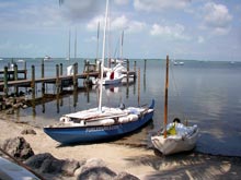 |
Oaracle on the beach at Key Largo, next to the amazing Sand Flea. |
Some folks reckoned this was one of the harder challenges because of the protracted headwinds. I’m still mulling that over. Last year, Noel and I were double reefed most of the time we were under sail; this year I don’t think we ever contemplated using the second reef, and we had calms on the first and last days. It certainly would have been tougher had we been paddling and even under sail, it took lots of endurance to deal with the long windward legs. Maybe the answer that each year is its own unique Everglades Challenge with its own unique requirements.
Complete results for the 2008 Everglades Challenge are here: https://www.watertribe.com/DataAccess/Results.aspx
|