(Authors’ note: Following a style used on articles about the 2013 and 2015 Everglades Challenges, the following story is written in alternating sections by the authors. Gary Blankenship wrote the main narrative, Gary Sabitsch added a daily summary of his thoughts. Those are in italics. Each contributed to the final editing of the article. Gary Sabitsch was a first time EC participant and wrote a longer, separate account that will appear in the July/August issue (#100) of Small Craft Advisor. Look for it there.)
Part One - Part Two - Part Three - Part Four
After some more fiddling and organizing, we rowed back out to the ICW just before 9 p.m.
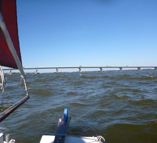
The wind was very light in the narrow channel that connects southern Lemon Bay with Gasparilla Sound, and we loafed along at 2 to 3 knots. The forecast was for strong winds, perhaps 15 to 20, so I didn’t want to shake out the reef only to be putting it back in a few minutes later. But after our wild ride down the coast, it felt . . . sedate. We picked up a little speed at Gasparilla Sound and soon were at the new swing bridge. The old bridge had about nine feet of clearance, but the helpful bridge tender informed us by radio that the span, constructed since I was last here in 2013, had 22 feet at the center and 24 feet at the ends – easy for Oaracle which needs about 20 feet with full sail and less when reefed.
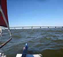
Clearing that bridge and gliding through the open span of the abandoned railroad bridge to the south, we entered the north side of Charlotte Harbor, which widened ahead of us. The wind picked up and soon we were averaging around 5 knots. The sailing was fairly straightforward: pick out the next flashing marker ahead and head for it, using the GPS to warn us of upcoming unlit markers so we could pick them out with the Maglight ahead of time. Around midnight, Boca Grande Inlet came abeam. Luck was with us, there was very little current which can kick up a nasty chop if it opposes the wind. Crossing the mouth, we followed the channel to the north end of Pine Island Sound. It was time to sort out our options. The wind picked up a bit and Oaracle was doing 6 knots. There were a series of small islands to the west of the channel. Once passed, there was no good stopping place until the south end of Pine Island Sound, another dozen or so miles ahead, and the winds were predicted to remain strong. The tentative plan had been to get some rest during the day, but the wild ride down the gulf put an end to that. We decided to pull off and catch a little rest, and so after some short tacking in shallow water, the anchor went down behind Cabbage Key, the last of the small islands, at 1:30 a.m. It protected us from the northern wind and would do so if it shifted to the predicted northeasterly. We cleared the cabin by putting the dry bags in cockpit, ate a bit, and turned in. I got up at 5:30 to make sure the falling tide hadn’t grounded us (it didn’t), and an hour later we got up, ate breakfast, restowed the dry bags, lifted the anchor, and raised the sail at 7:30, still with one reef tied in.
 |
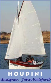
One of the windsurfers participating in the EC (I didn’t find out which one this was) passed us shortly after we upped anchor and resumed sailing in Pine Island Sound on Sunday morning. |
Good thing. The wind was strong and the weather radio predicted it might reach 20. There were whitecaps not long after we made it back to the ICW and we sped south, first doing 6 knots and then averaging 7 and better. In the shallow sound, the waves weren’t as big as the previous day in the gulf and we weren’t surfing much, but the wind was stronger and whitecaps were everywhere. Oaracle stayed in control but when we got to a calm patch of water, the second reef went in. The windy conditions had the advantage of keeping down the powerboat traffic, at least until the southern partbottom of the sound.
 |
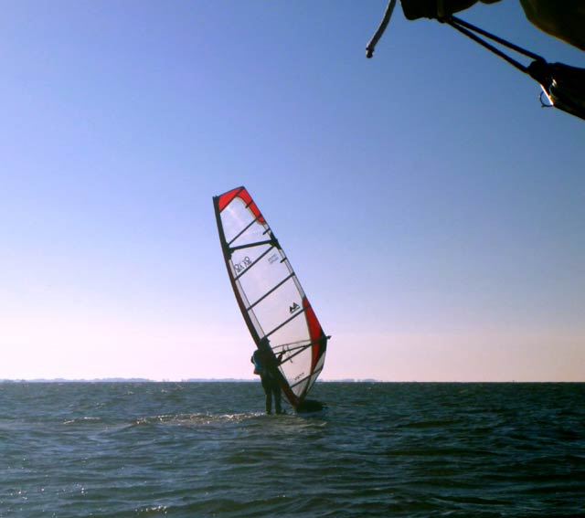
Heading south down Pine Island Sound on Sunday morning. |
Around 9:15, we reached the southern part, having run about 12 nautical miles in less than two hours, and headed east to depart the sound exit into the gulf at Point Ybel. The wind had shifted to the north east so some tacking was needed against a stiff tide. Eventually, we were able to cut south for the western exit under the Sanibel Causeway. The last couple miles were rocky, even though the wind had eased slightly. But the combination of wind waves, motorboat wakes, and reverberations from sea walls and bridge pilings created an anarchic slop. We finally reached the channel under the bridge and discovered even though it was about high tide, there was a robust incoming current. We made it most of the way through under when the bridge blocked the wind and we drifted into the wooden abutment. Gary fended off and we got clear, only to nearly be sucked back under the next span of the bridge. We eventually got clear through of the bridge, but the wind had gone light and the water was still very choppy in the bay formed by the bridge and Point Ybel.
 |
We had light winds and choppy seas after passing under the bridge at the south end of Pine Island Sound. |
I was reluctant to pause to unreef the sail for fear we would be pushed back to the bridge or close to the nearby shore, so Oaracle plodded on sometimes barely doing two knots. It took almost an hour and one tack, but we finally squeezed by Point Ybel with its lovely beach and pier. The waves became more settled and the wind picked up. At least one reef could have come out, but I was still being cautious because of the weather forecast for continued strong breezes. We angled to close with the coast, to get a bit of protection from the waves. Eventually, both reefs did come came out as the wind mostly moderated, but was occasionally puffy. Mostly Oaracle slid along making 4 to 5 knots.
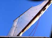 |
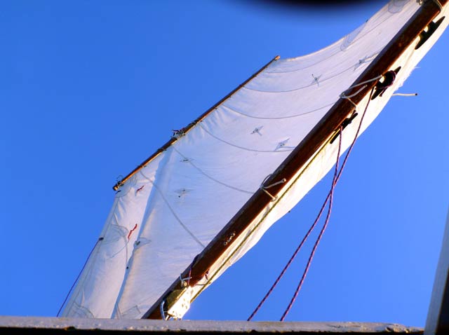
Oaracle’s balanced lug mainsail, seen looking up from the cabin. |
 |
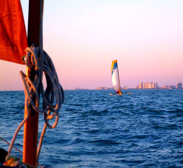
A Hobie Adventure Island passes us at sunset off the coast of Naples. |
 |
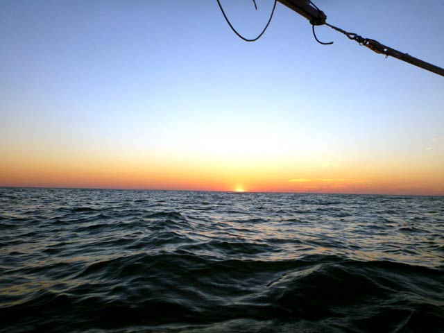
Spectacular sunsets and sunrises are normal for an EC; this one was Sunday night off Naples. |
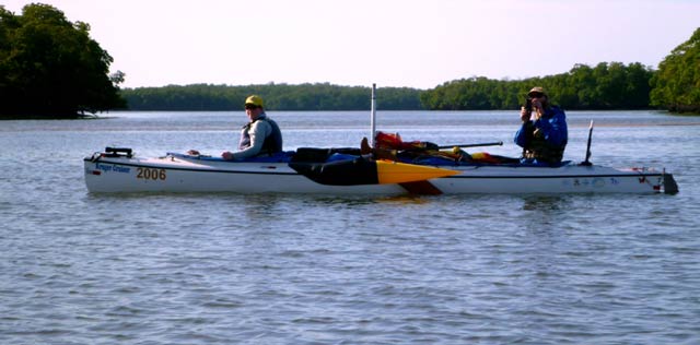
There was a spectacular orange sunset off Naples, some temporarily strong winds as we reached Marco Island, and pitch blackness for the stretch from Marco Island to Cape Romano, which we reached at 11:30 p.m. There was good news and bad news. The bad was it was just after high tide and there was a strong outgoing current over the shoals at the cape. We were already almost hard on the wind when we got to the cape, so could only point up a little bit. There was about a 15-degree difference between the compass and the GPS because of the current. The good news is we made it over the shoals without bumping the leeboard even once. The rest of the night was spent crossing Gullivan Bay, averaging 3 to 3.5 knots. Sailing directly to Indian Key Pass, the entry way to Chokoloskee Bay and Checkpoint 2, wasn’t possible in the northeast wind, so one long tack was needed. Nearing the channel on the north side of Indian Key, we could hear powerful diesel engines and see bright lights as commercial fishing boats headed out from Everglades City. Around 5:45, with some hints of a lightening sky in the east, we eased into a protected shallow area behind two small islands north of Indian Key and anchored. There was time to grab an hour of sleep before taking full advantage of an incoming tide. At 7:30, after a quickly gulped breakfast, Oaracle was back underway. We had come to Chokoloskee early in December in part to practice going up Indian Key Pass and had nearly the same wind direction, although a bit gentler velocity this time. About a third of the way through, Windward Mark and Leeward Lauren (Mark Rowe and Lauren Fry) in their sailing Kruger canoe came paddling by, doing better with paddles that we were doing under sail.
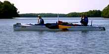 |
Windward Mark and Leeward Lauren paddled past us in Indian Key Pass on Monday morning. |
In two hours, we had tacked through the pass, narrow sections and all, without having to resort to oars and entered the north end of Chokoloskee Bay. Checkpoint 2 was a tantalizing 3.2 miles away. And tantalizing it would remain for a while. When we reached the bay the wind, no longer protected by the mangroves, increased to at least 15 knots and probably a bit more. It had also shifted to the east, maybe even a bit south of east. That meant there was no cutting out of the channel early to head for the CP. And although the wind was now uncomfortably strong for the full sail, there was no place to pause to reef without going aground. It would be long and short tacks, with the starboard tack favored, up the narrow channel, and then long and short tacks, with the port tack favored to the checkpoint. Since the tides at Chokoloskee are about two hours behind Indian Key, the bay was still very shallow and we couldn’t get much of the leeboard down. It took another two hours and a lot of tacking. We passed a two other competitors in a red trimaran, who ran aground in the channel and then passed us on the long tacks down the bay. The arrival at CP 2 shortly after 11 a.m. was not long after low tide, soon enough that we experienced some of the famous Chokoloskee mud. But we made it ashore, signed in, picked up some bottled water at the store to replace what we had consumed, got ice cream sandwiches, and made preparations to leave at high tide, including putting a double reef in the sail.
The weather forecast now talked of a high pressure system parked off the eastern U.S. coast which would pump blustery east and east-southeast winds over the remainder of the course. With luck, no tacking might be required down the Everglades Coast to Cape Sable, but from there it would be beating to checkpoint 3 at Flamingo and then the finish. It would also require going around Florida Bay instead of taking the direct route across, adding 20 or so miles to the route. The winds for the rest of that day and night were predicted at 15 to 20. After that, the forecast spoke of winds in the 20 to 25 knot range with higher gusts. We tried to get some rest, but that was mostly futile. Other competitors were landing, we were getting ready to depart, other competitors who had dropped out earlier showed up to offer encouragement and swap tales. I found a few minutes to lie down, and I think Gary did, but it was rest without sleep.
Second Leg perspective from a first timer:
After all the excitement of getting to the first checkpoint, the beginning of the second leg was well… a bit slow. After leaving checkpoint one we eased back out into the channel and proceeded south with just enough wind to keep us moving. A favorable current helped and we slowly passed waterfront homes close enough to see tables and chairs. After a bit the winds picked up and real progress was made and often in the company of other Watertribe competitors. We carefully made way by markers in the dark and did not hit anything that was in front of us. Well into the night we ducked behind an island and dropped anchor for a few hours of sleep. An early alarm got us up, fed and off again. As we trucked down Pine Island Sound a stiff wind returned and we were once again making very good time. Gary turned the helm over to me and somewhere in my mind the near dumps from the day before got the best of me. I was not in control. My hand was on the tiller and all seemed good but the wind and the chop got the best of me. I swallowed my pride and let common sense rule, after just a few minutes I handed the tiller back to Gary. I needed to get my head straight. Within an hour or so I was back in the saddle and overcame whatever wimpy nerves had struck me.
The sail down the sound became another nice stretch on the water. Most of the big motor boats heading out to the gulf were considerate of the amount of wake they sent us and we waved in thanks to them. Some were not but we refrained from any single finger waves that a few earned with their lack of boating manners with respect to small motor-less boats. We experienced some trials getting back out to open water but once we did it was a nice late afternoon sail down to Naples and not long after passing all the big hotels along the coast we were treated to a brilliant orange sunset. We moved on and headed for Marco Island. After dark the winds picked up and again and we were once again riding waves and making good time. We did our best to rest each time we handed off the helm, sometimes with greater success than others. At this point we had been on the water for a day and a half with short naps counting as sleep. After passing Marco Island Cape Romano we headed toward Indian Key Pass in the dark and here is where knowing the course helps. I can’t count the number of times Gary indicated that “there is a shoal over there we need to avoid” or “we need tack before we hit that shoal”. On my own I would have just bumped into the shoals and tried to recover.
Indian Key Pass is nothing short of beautiful and after a short one-hour nap at sunrise we got to navigate it at the first light of the morning. While not far from the checkpoint, we spent a lot of time getting there. By late morning we had landed on the muddy beaches of Chokoloskee and were happy to see other Watertribers and this thing called a store where they had this thing called a restroom. Civilization is great. We bought some colds sodas to help the cooler stay cold and ate jumbo ice cream sandwiches. We laid out some things to dry and got a mini nap before heading out again. We were past the second checkpoint and most everything had gone well. It was time to say goodbye to civilization. After Chokoloskee there is nothing down the west coast of Florida, no towns, no homes, no power lines, no nothing! Just a great place to be.
|